
Ecola | MARINe
Ecola
Click here for Long-Term trends
Click here for Biodiversity Survey findings
Ecola is located in Oregon, within Ecola State Park and Lewis and Clark National Historical Park. The site was established on a section of moderately sloping, consolidated bedrock that is part of a larger rocky point (Ecola Point). Access to the site is restricted by a surge channel that is only crossable during low tide, and involves either a a long beach walk, or a trek down a steep slippery trail, so human visitation is limited. However, a handful of people are typically seen on good low tides, beachcombing, harvesting algae, or fishing. This moderately sloping site consists of moderately uneven terrain, containing few cracks and folds.
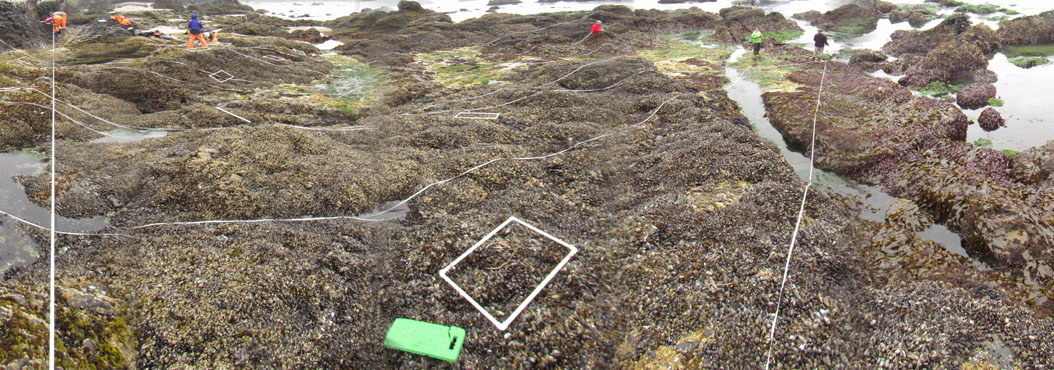
Ecola is dominated by consolidated bedrock, and the area surrounding the site is comprised of a mixture of consolidated bedrock, boulders, and sandy beach. The primary coastal orientation of this site is south.
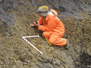
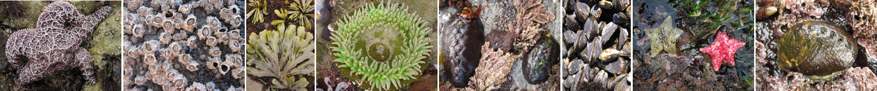
Long-Term Monitoring Surveys at Ecola were established in 2001 and are done by University of California Santa Cruz and Olympic National Park. Long-Term monitoring surveys currently target the following species: Chthamalus/Balanus (Acorn Barnacles), Mytilus (California Mussel), Pelvetiopsis (Dwarf Rockweed), Neorhodomela (Black Pine), Saccharina (Sea Cabbage), Phyllospadix (Surfgrass), and Pisaster (Ochre Star). Click here to view Long-Term trends at this site.
Biodiversity Surveys were done in 2001, 2005, 2014, 2019, and 2023. The Biodiversity Survey grid encompasses one section that is approximately 18.9 meters (along shore) x 33 meters (seaward). Click here to view Biodiversity Survey findings at this site.
For more information about Ecola, please contact Pete Raimondi (raimondi@ucsc.edu).
