
California Central | MARINe
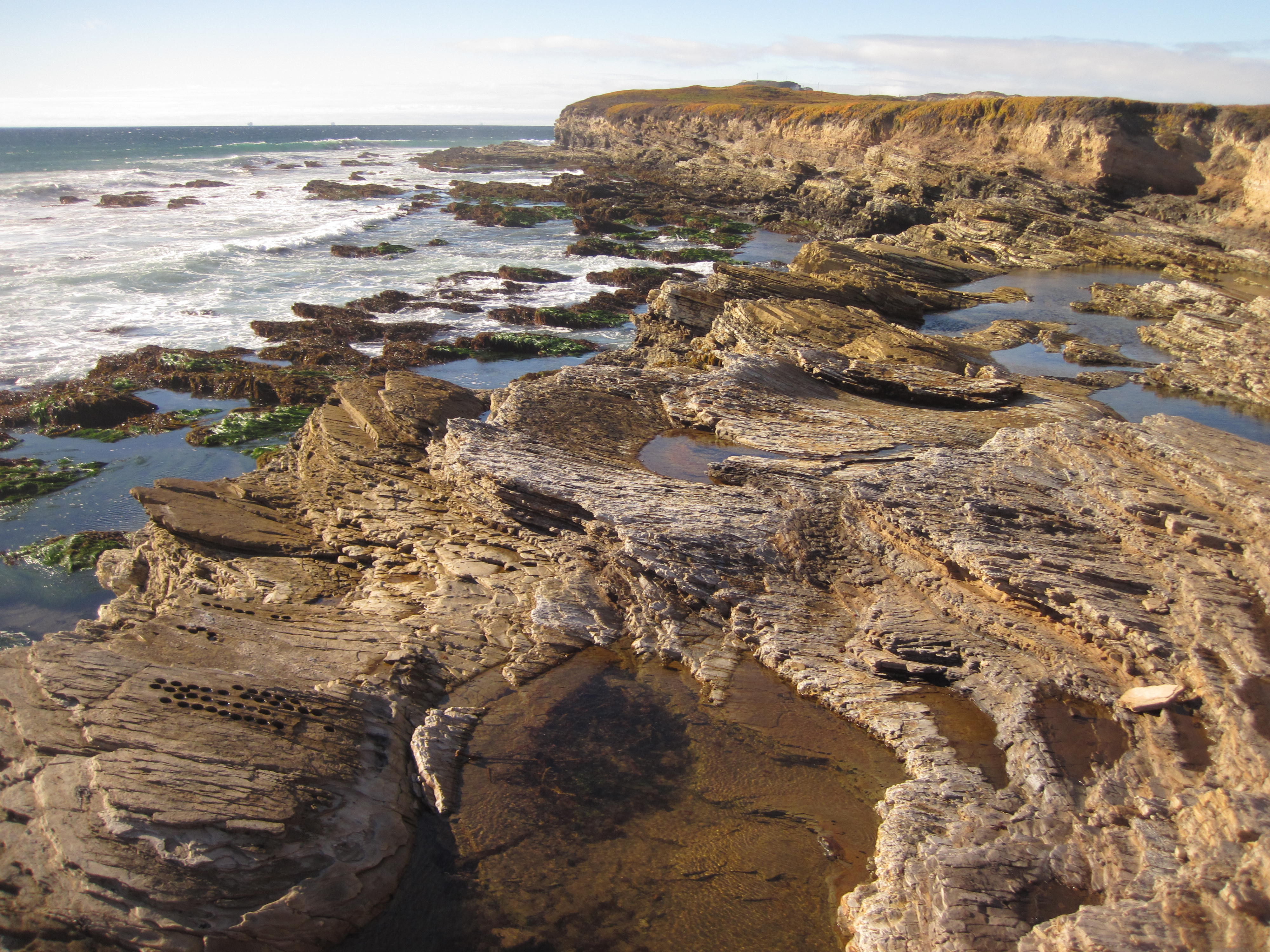
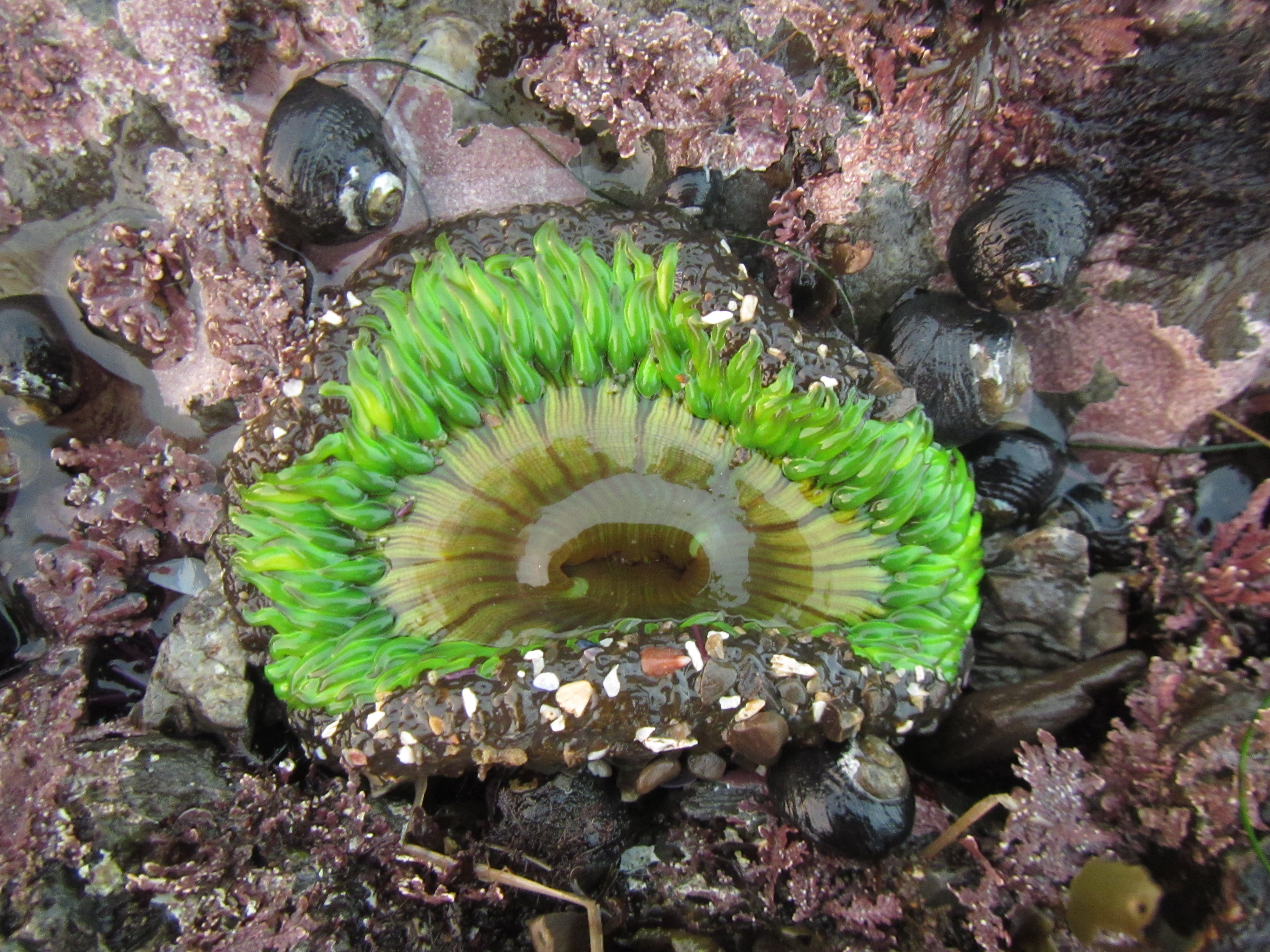
Rocky intertidal communities in Central California (Pigeon Point to Point Conception) are known for their diverse and relatively pristine biota. Much of the coast is remote and undeveloped but the natural beauty and coastal resources of this region, (which includes Monterey Bay, the Big Sur Coastline, and San Luis Obispo), make it a popular tourist destination. The Central California region is dominated by the cold-temperate Oregonian biogeographic province, but warmer-water species more characteristic of the southern (Californian) biogeographic province begin to show up in the southern portion of the region, and can move far to the north during El Niño events.
The rocky shore communities of Central California are vulnerable to oil spills, primarily from major coastal tanker traffic, but also from terminal operations and onshore pipeline breaks. Natural oil seeps also exist, resulting in the presence of tar on many rocky shores, particularly in the southern portion of the region. Spills from onshore operations have occurred at Avila (1992), Guadalupe (1994), and Vandenberg Air Force Base (1997) and spills from tankers have occurred in San Francisco (2007, 2009). All have affected marine resources to some degree.
A portion of the Central California region is included in the Monterey Bay National Marine Sanctuary (Pigeon Point to Cambria). The region includes thirteen State Marine Reserves, in which all fishing is prohibited, and fifteen State Marine Conservation Areas, in which limited commercial or recreational take is allowed (California Department of Fish and Game, 2007).
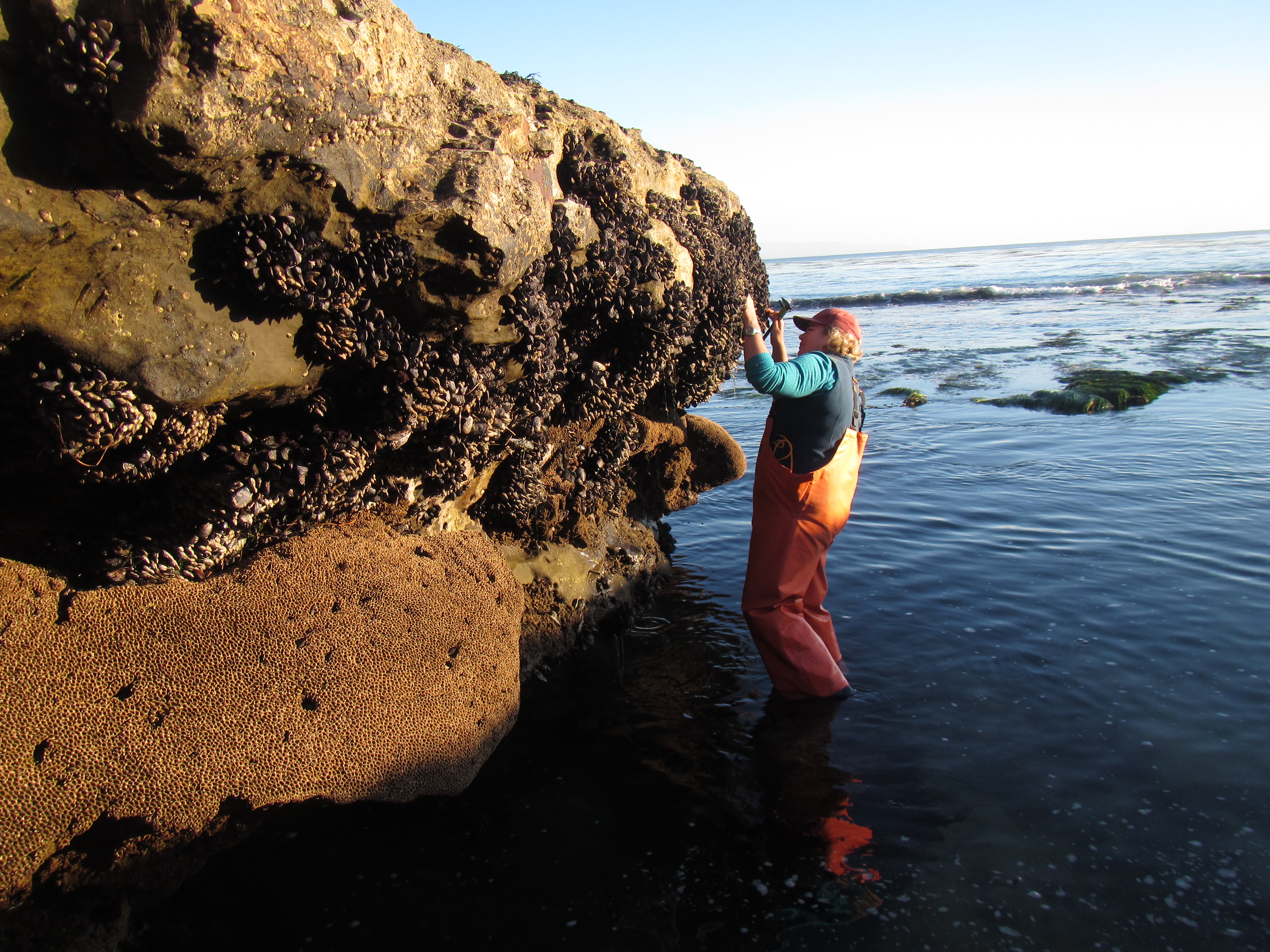
Extensive historical information about marine communities in this region is available, particularly for the Monterey Bay area, where several university marine labs (Long, Moss Landing, Hopkins) and research facilities (MBARI, NOAA, Elkhorn Slough NERR) are located. Farther south, long-term surveys were done to assess the impact of the Diablo Canyon Nuclear Power Plant on intertidal and near shore communities (North et al. 1989, Tenera Environmental 1988a, b, 1994). Research on seasonal and successional variation in intertidal community structure was done at three sites within the region (Kinnetics Laboratories, Inc. 1992a, b), and MARINe Long-Term monitoring has been done in the Central California region since 1992. Baseline monitoring for newly established Marine Protected Areas began in 2007. Within this region, 40 Long-Term sites have been established, 10 of which are BOEM-funded. Sea star monitoring sites were established in 2015, in conjunction with citizen science groups.
The MARINe sites located within the California Central Coast California region are listed below (arranged north to south):
