S Frenchys Cove | MARINe
S Frenchys Cove
Click here for Long-Term trends
Click here for Biodiversity Survey findings
S Frenchys Cove is located in the Northern Channel Islands, within the Channel Islands National Marine Sanctuary, on Anacapa Island. This site is located in an Area of Special Biological Significance (Santa Barbara Island and Anacapa Island ASBS) within the Anacapa Island Special Closure in Channel Islands National Park. The site is the first reef from the access point, or gap, near the east end of West Anacapa Island. The second reef (first major point) includes one of the historic study sites used for a baseline study of the Southern California Bight (conducted by the Bureau of Land Management in 1978-79). This second reef is also referred to as the "blowhole", and is where the majority of visitors go. This site receives 1500-3000 visitors per year, primarily tidepoolers. The site consists of a number of solid rocky reefs one to almost two meters above zero tide level. The reef is quite level with little change in elevation from the cliff out to the end of the mussel plots.
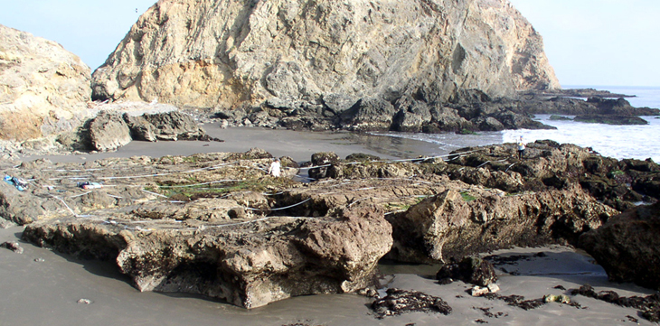
S Frenchys Cove is dominated by a mixture of consolidated volcanic bedrock and sandy beach, and the area surrounding the site is comprised of a mixture of consolidated bedrock and sandy beach. The outer reef has a fairly dense mussel bed and even at low tide is washed by large swells. The primary coastal orientation of this site is south.
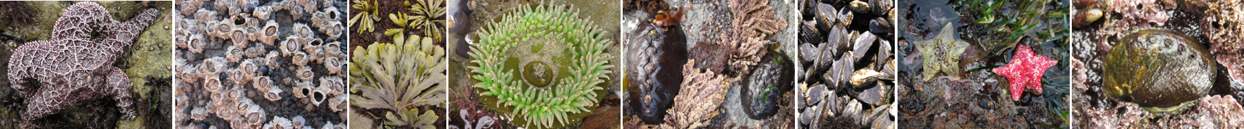
Long-Term Monitoring Surveys at S Frenchys Cove were established in 1982, and are done by Channel Islands National Park. Long-Term MARINe surveys currently target the following species: Chthamalus/Balanus (Acorn Barnacles), Mytilus (California Mussel), Silvetia (Golden Rockweed), and Endocladia (Turfweed). In addition, motile invertebrates, mussel size structure, and water temperature are monitored at this site. Click here to view Long-Term trends at this site.
Biodiversity Surveys were done in 2001, 2005, and 2012. The Biodiversity Survey grid encompasses one section that is approximately 20 meters (along shore) x 33 meters (seaward). Click here to view Biodiversity Survey findings at this site.
This site is also regularly surveyed by LiMPETS (Long-term Monitoring Program and Experiential Training for Students) which is an environmental monitoring and education program for students, educators, and volunteer groups. You can access site specific data from this citizen scientist and educational broad scale trend monitoring program.
For more information about S Frenchys Cove, please contact Stephen Whitaker (stephen_whitaker@nps.gov).
See Also
