
Oregon | MARINe
The nearly 600 km of Oregon coastline contains numerous rocky headlands and extensive rocky benches, separated by long stretches of sandy beaches. Rocky habitat is estimated to be approximately 21% of the coastline. An important feature of the Oregon coast is the extensive system of rivers that empty into the near shore environment, providing substantial estuarine habitat, and replenishing sandy shores. Freshwater and sediment input from the Columbia River in the north is particularly high, draining one of the largest river basins in North America, and forming a mainly freshwater estuary that is larger than all of Oregon’s other estuaries combined.
Highway 101 follows the coast through much of Oregon, allowing easy access to the shore. Oregon tidepools attract hundreds of thousands of visitors annually, which provides important revenue for coastal communities, but concerns have arisen about the impacts of so many visitors to rocky shores. Efforts have been made to reduce this impact, including the conversion of a coastal quarry to artificial tidepools at Yaquina Head. The Oregon Department of Fish & Wildlife recently designated 5 areas as marine reserves in order to improve the balance between recreation and resource protection.
As with other regions, the threat of oil spills is an important concern for the Oregon Coast. The most recent major spill was in 1999, when the New Carissa freighter ran aground near Coos Bay, eventually breaking in half and spilling fuel into the marine environment. A portion of the ship could not be salvaged and was sunk offshore of Waldport.
A more recently recognized threat to Oregon’s coastal marine communities involves a change in near-shore water movement patterns, which results in hypoxic (low oxygen) conditions. Periodic coastal upwelling in the summer, which brings cold, nutrient rich, but oxygen poor water to the surface, is normally interspersed with down-welling events, which mix in oxygen-rich water. However, since 2002, upwelling conditions have persisted longer than normal, and persistent hypoxic conditions have led to massive die-offs of fish, shellfish and sea stars.
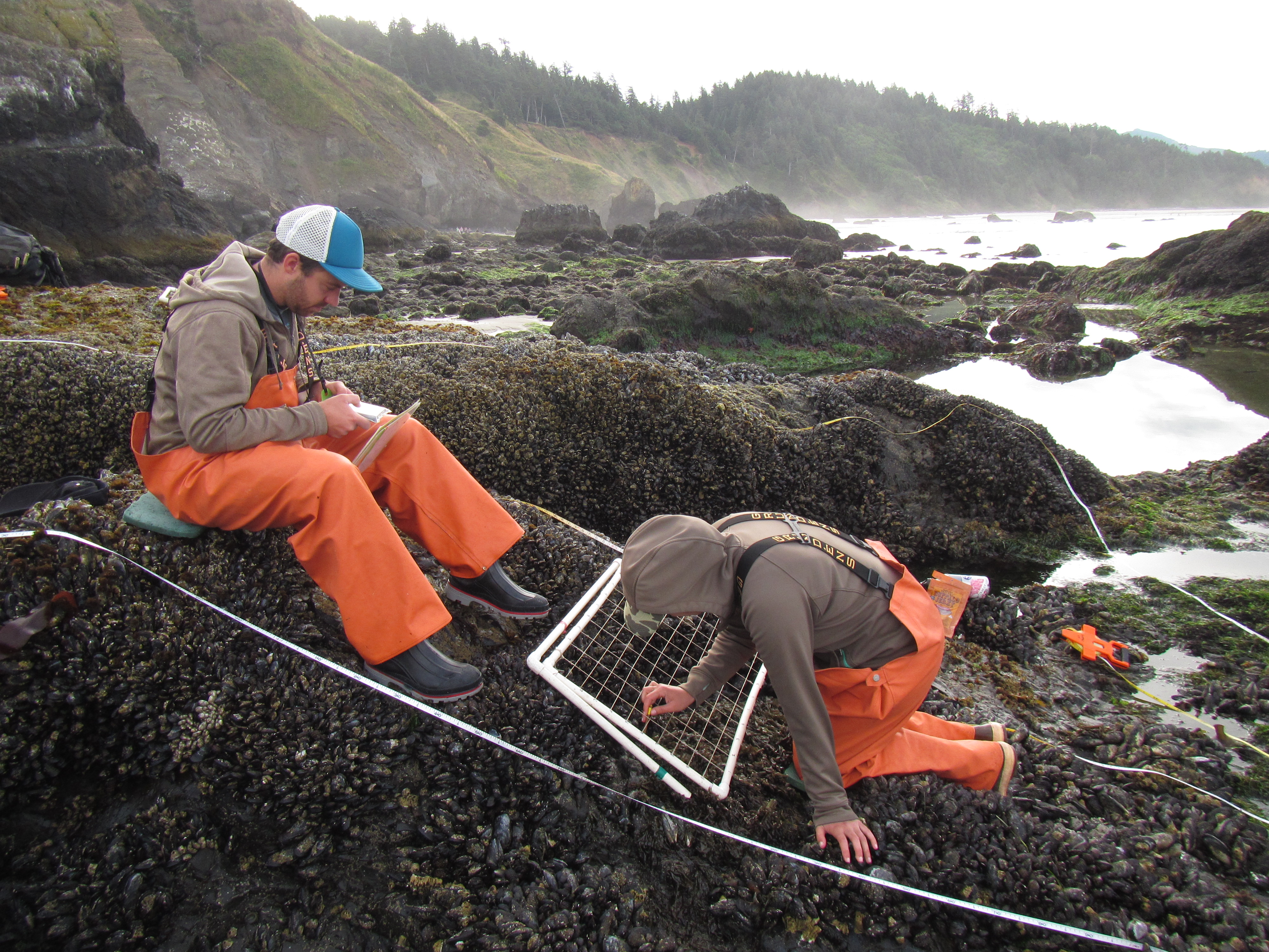
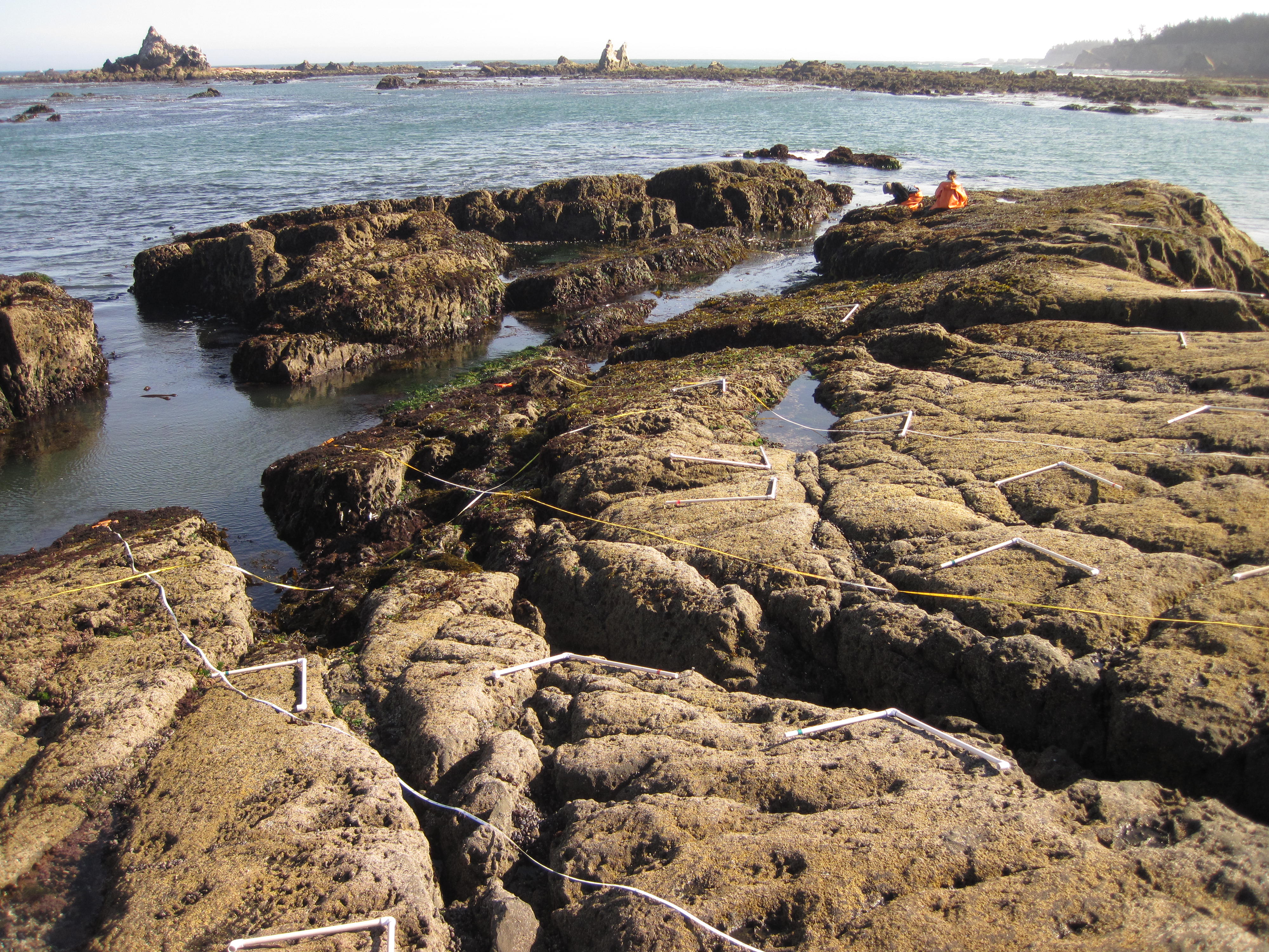
Numerous intertidal studies along the Oregon coast have originated from the Hatfield Marine Science Center (Oregon State), located in Newport, and from the Oregon Institute of Marine Biology (University of Oregon) in Charleston. MARINe Long-Term monitoring has been done in this region since 2000 and Biodiversity surveys since 2001. Sea star monitoring sites were established in 2014, in conjunction with citizen science groups.
In recent years, there has been increased interest in developing alternative energy facilities along the west coast, in the form of wave and wind energy conversion devices. Because the wave energy devices require considerable wave energy to make this a viable venture, the wave regime of Oregon appears to be an ideal area for these devices. Wave energy facilities, and their associated construction and development activities, have the potential to impact coastal resources, and BOEM has funded several studies to begin investigating these potential impacts. Wave energy collection devices could lead to a dampening of wave height, which could in turn affect the abundance, distribution, and makeup of nearby rocky intertidal communities. Determining an approach that would allow for the assessment of these potential impacts was the focus of this study.
The MARINe sites located within the Oregon are listed below (arranged north to south):
